Sport

Col de Villard

  • Pets welcome
  •   510 m
  •   3h45
  •   10.46km
Die

About

  • Pets welcome

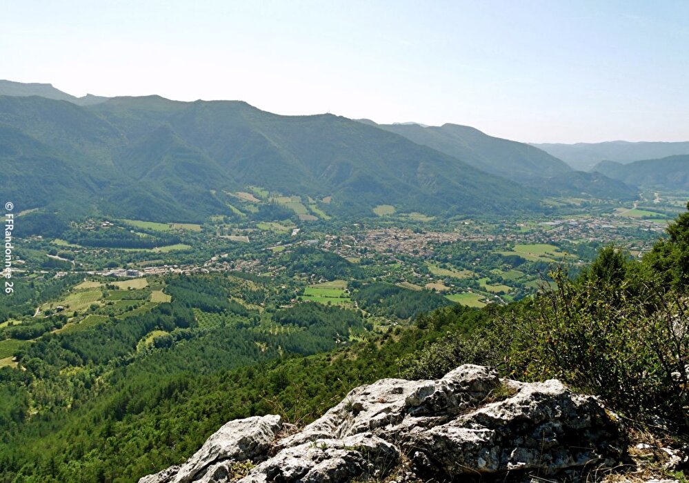
Accompanied by the sound of the Canal des Fondeaux and the Clairette de Die vineyards, take in the scents of the pine forest at the foot of the Vercors cliffs as you zigzag along a small path leading to the lookout overlooking Die.

Step by step

1/ At the Die sign (alt. 408m), walk past the Tourist Office and continue along rue des Jardins to pass under the D93 bridge. At the corner of Place Antonin-Chevandier (> left, Porte Saint-Marcel), turn right into Rue du Faubourg Saint-Marcel. Turn left onto avenue Rhin-et-Danube (D742), taking advantage of the pedestrian facilities.
Coordinates: (44.7515072, 5.3726216)
Distance from starting point: 9 m
2/ After Le Camping (alt. 423m), leave the GR® 95 to the right and go straight on for 600 m. Before the bridge, turn right onto chemin de l'Hommet.
Coordinates: (44.7551669, 5.3790821)
Distance from starting point: 816 m
3/ At the end of the road, at L'Hommet (alt. 470m), go straight ahead on the path for 180 m, then climb to the right along the edge of the meadow before entering the pine forest. The very pleasant path winds up to the Col de Villard (alt. 833m).
Coordinates: (44.7600224, 5.3895391)
Distance from starting point: 2 km
4/ On the other side of the pass, switch to the north-east side of the mountain. The shady descent leads to the Col de Ginayes (alt. 773m).
Coordinates: (44.7608654, 5.4031004)
Distance from starting point: 4 km
5/ Turn left at 180° and lose altitude. Follow the meadow upwards and find the parallel path hidden in the woods. At the end of the field, head downhill to reach Pont de la Roche (alt. 475m).
Coordinates: (44.7621147, 5.4096378)
Distance from starting point: 5 km
6/ Turn left onto the D742 to cross the gorge. After 50 m, turn right and use the footbridge over the Meyrosse stream. The path leads to the Fondeaux crossroads (alt. 435m).
Coordinates: (44.7726264, 5.4011406)
Distance from starting point: 7 km
7/ Continue straight ahead on the road to Die, then via rue de la Montée des Usines, place Antonin-Chevandier and rue des Jardins, to the Tourist Office and parking lot.
Coordinates: (44.7629578, 5.384704)
Distance from starting point: 9 km

Practical information

  • Services Pets welcome
  • Amenities Free car park Car park Public WC

Prices

Free access.

Information updated on 04/05/26 by the Pays Diois Tourist Office